Carter Dome via Carter Notch - Trail Guide & Trip Report (White Mountains, NH)

Carter Notch, New Hampshire · 44.27°N 71.19°W
Carter
Dome
19 Mile Brook → Carter Notch → Summit → Zeta Pass
- Dist
- 12.37 mi
- Gain
- 3,480′
- Time
- 5:50
The Trail
Steep, grueling, and geologically dramatic, the Carter Dome loop through Carter Notch is one of the White Mountains' most striking routes. Towering cliffs, glacier-carved ponds, and sweeping Presidential views make the effort unforgettable.
Carter Dome tops out at 4,832 feet, the high point of the Carter–Moriah Range across Pinkham Notch from the Presidentials. Most hikers climb it directly, but the far better day links it with Carter Notch — a glacier-carved cleft of boulders and ponds wedged between Carter Dome and Wildcat.
From the 19 Mile Brook Trailhead the route climbs gently up valley, drops into the notch past its ponds and historic hut, then attacks the brutally steep headwall to the summit before looping back over Zeta Pass. Rugged footing and constant elevation change make it a long day, but few places in the Whites feel this geologically dramatic.

FROM THE TRAIL JOURNAL
Field Notes
I almost climbed Carter Dome the direct way and called it a day. I'm glad I didn't. Routing through the notch first turns a checklist summit into one of the most dramatic walks in the Whites.
Breaking into Carter Notch felt like stepping into another world — towering cliffs on both sides, massive boulders scattered around the ponds, a scene that could easily belong in Colorado. Even in drought, with the water low, it stopped me in my tracks. The climb out of the notch to the dome is punishing, but every brutal step pays off at the overlook.
Steep, rugged, and unforgettable — exactly why I keep coming back to this range.
— Anton

Trail Diary
19 Mile Brook Trailhead
I set off from the gravel lot on Route 16. The first few miles followed the brook through damp forest — the kind of trail that always feels wet, even in drought. Mud, slick roots, and mossy stones made footing tricky. The river's cascades gave the otherwise rugged approach some charm.
Carter Dome / Carter Notch Junction
Here the trail split: left up toward Carter Dome, or right toward Carter Notch Hut. Most hikers aiming for Carter Dome would climb directly, but I wanted the full loop through Carter Notch. The tread became rockier and drier as I continued up valley.
Carter Notch Ponds
Breaking into Carter Notch felt like stepping into another world. Towering cliffs rose on both sides, with massive boulders scattered around the dramatic mountain pond. Despite drought conditions, the scene was unforgettable — a place that could easily belong in Colorado.
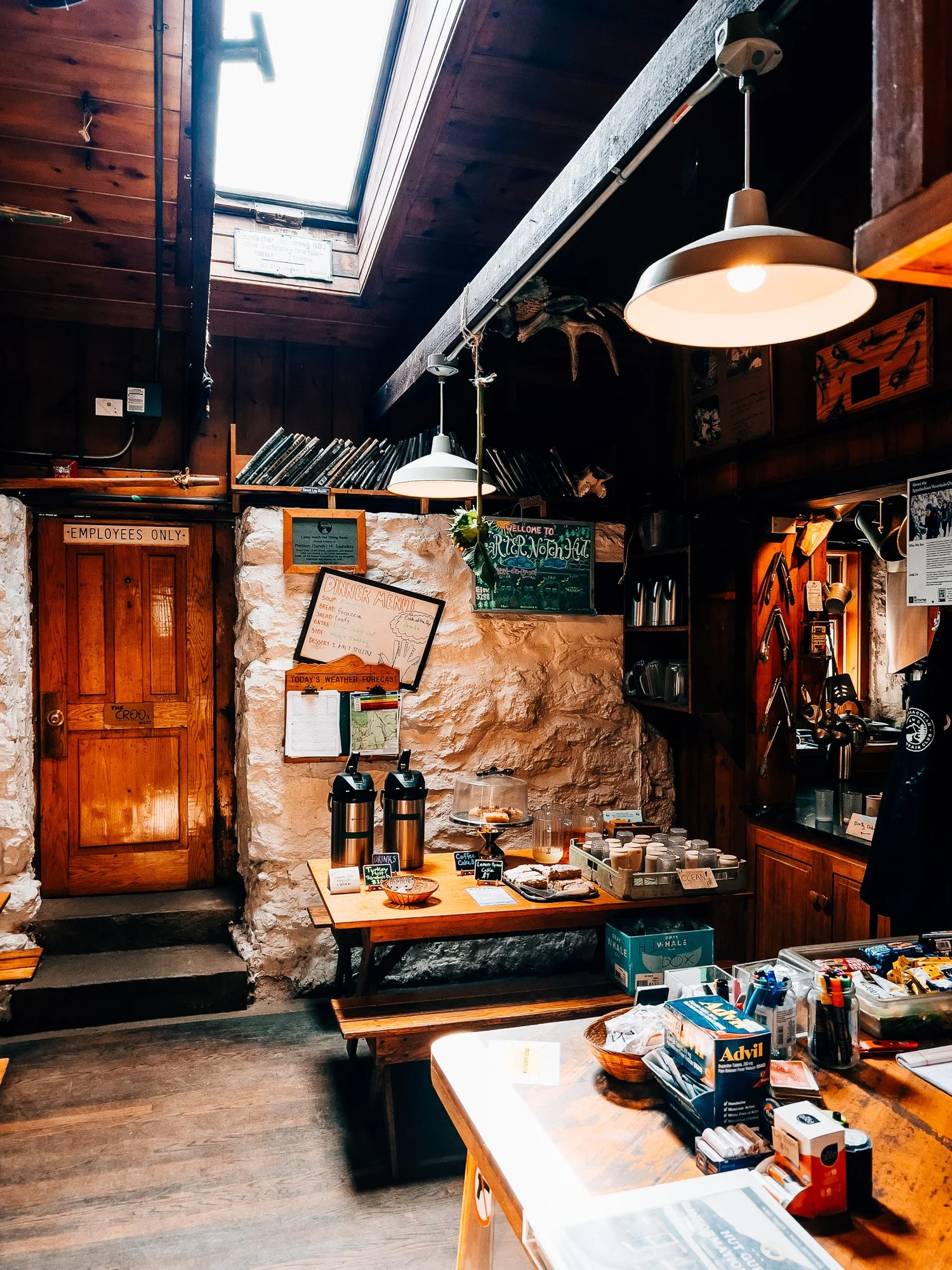
Carter Notch Hut
The hut is small, rustic, and cozy, perched between the two ponds. I ducked inside for a quick look, then turned uphill toward Carter Dome.
Climbing to Carter Dome
The ascent from Carter Notch to Carter Dome is brutally steep, with constant elevation gain on rugged footing. After a slow, punishing half mile, I broke out to breathtaking views back over the notch — the Wild River Wilderness off to the east, the Presidentials dominating the west, and the vast boulder-littered moraine of the notch below. Few places in the Whites feel this geologically dramatic.


Carter Dome Summit — 4,832 ft
The summit itself is modest — the marker rests on a concrete slab in the trees — but just beyond, an outlook offers stunning views of the Presidential Range. Washington and the southern Presidentials filled the horizon, framed by the open ridge. This was the true highlight of the summit experience.
Zeta Pass
The descent toward Zeta Pass was steady, winding down through mossy woods. From here, I looped back to rejoin the 19 Mile Brook Trail.
Back at the Trailhead
Back at the lot after a rugged, rewarding loop through one of the most dramatic notches in the White Mountains.
Hike Summary
- Name
- Carter Dome
- Location
- Carter–Moriah Range, White Mountain National Forest, NH
- Route
- 19 Mile Brook Trail → Carter Notch → Carter Dome → Zeta Pass → 19 Mile Brook (loop)
- Distance
- 12.37 miles
- Elevation Gain
- 3,480 feet
- Total Time
- 5 hrs 50 min
- Class
- Class 2
- Access
- 19 Mile Brook TH — pull off on Route 16. 2WD accessible. Fills quickly on weekends.
Trail Features
What you'll find along the way —
-
01
Carter Notch
One of the most dramatic glacial cirques in the White Mountains — sheer cliffs rising several hundred feet on both sides, two cold mountain ponds in the basin, and massive boulders scattered across the floor.
-
02
Carter Notch Hut
The AMC's smallest backcountry hut, perched between the two ponds at the foot of the cliffs. A great place to refill water and take in the scale of the notch before the climb.
-
03
Presidential Views
The overlook just below the summit delivers one of the best views of the Presidential Range in the Whites — Washington and the southern peaks spread across the horizon to the west.
-
04
Wild River Wilderness
From the Carter Dome ridge, the Wild River Wilderness opens up to the east — a vast, roadless expanse that sees far fewer visitors than the western White Mountains.
Recorded with Strava
Open Activity Recorded with Strava
Gallery


Until the next ridge,
Anton
Follow the trail @antonpugphoto →

Disclaimer
Everything you find here, whether it's a hiking guide or a trail story, is meant for inspiration, not instruction. I'm not a guide, and I'm not responsible for what happens if you decide to follow a wrong turn or take on more trail than you're ready for.
The outdoors can be unpredictable, so always use your own judgment, check official resources, and know your limits. By using this site, you agree it's all at your own risk. Take what inspires you, leave what doesn't, and go make it your own adventure.
Enjoyed the trip report? Pass it along to a hiking partner.