Mount Sneffels 14er Hike – Trail Guide & Trip Report (San Juan Mountains, Colorado)
San Juan Mountains, Colorado · 37.99°N 107.79°W
Mount
Sneffels
Yankee Boy Basin TH → Scree Gully → V-Notch → Summit
- Dist
- 2.4 mi
- Gain
- 1,600′
- Time
- 4:10

The Trail
An early start, a gnarly Jeep road, and one of Colorado's most stunning summit views. Short on distance but big on character, Mount Sneffels packs a loose scree gully and a genuine Class 3 crux into a quick, unforgettable San Juan morning.
Mount Sneffels rises to 14,150 feet above Ouray, the crown of the rugged Sneffels Range and one of the most photographed peaks in Colorado. The standard route from upper Yankee Boy Basin is remarkably short — just 1.2 miles to the summit — but it earns its Class 3 rating.
The day really begins with the drive: a rough, high-clearance Jeep road that deteriorates into ruts, potholes, and tight switchbacks above the lower trailhead. From the upper lot the trail climbs a loose scree gully to a saddle, then finishes through the V-notch — a narrow rock slot with a steep drop behind you — and a short scramble to the top.

FROM THE TRAIL JOURNAL
Field Notes
Three alarms to get out of the glamping tent at 3 a.m. Coffee, electrolytes, and out into the dark toward a Jeep road I'd been warned about. It lived up to the warnings — ruts, drop-offs, and a sign telling short-wheelbase 4WDs only beyond this point.
But starting that early bought me the whole mountain to myself. I climbed the scree gully by moonlight, hit the saddle just as the ridgelines turned gold, and wedged through the V-notch with the sun coming up. The summit was empty, the light was unreal, and I could even pick out my Jeep as a tiny speck far below. One of those mornings that reminds you exactly why you do this.
Tired legs, full heart — and the best summit light I've had all year.
— Anton

Trail Diary
3 a.m. Start
It took three alarms to get me out of the glamping tent. I made coffee, mixed up a bottle of Nuun electrolyte water, and headed for the trailhead in the dark.

Up the 4WD Road
Past the lower 2WD trailhead the road deteriorated fast — ruts, rocks, and steep drop-offs. Around 4:00 I hit the warning sign: "Recommended high clearance four-wheel drive short wheelbase vehicles only beyond this point." It got serious from there, with deep potholes and tight switchbacks in the dark.

Upper Trailhead — by Moonlight
Reached the upper 4WD trailhead under a full moon and a sky full of stars, with a few other hikers' lights visible in the distance. Only 1.2 miles to the summit from here. I started up the gentle lower incline of upper Yankee Boy Basin — the moonlight was bright enough that I didn't even need a headlamp.

Blue Lakes Junction
Reached the trail junction — Blue Lakes to the left, Sneffels to the right. Half a mile down, 0.7 to go.
Into the Scree
Hit the scree field — loose rock with that maddening one-step-up, half-a-step-back slipping. Careful footing the whole way. Meanwhile, light started creeping over the horizon and I kept stopping for photos as the ridgelines lit up.


The Saddle & Golden Light
Reached the saddle to unreal golden light on the ridgelines. I had a snack, drank some water, and put on my helmet for the exposed section ahead.

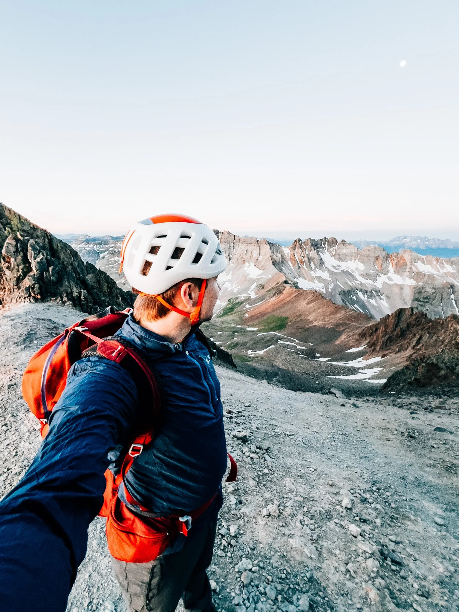

The Chimney
Hit the chimney, which held a small firm patch of snow. No technical gear was needed to climb it, though I'd packed crampons for the descent just in case.
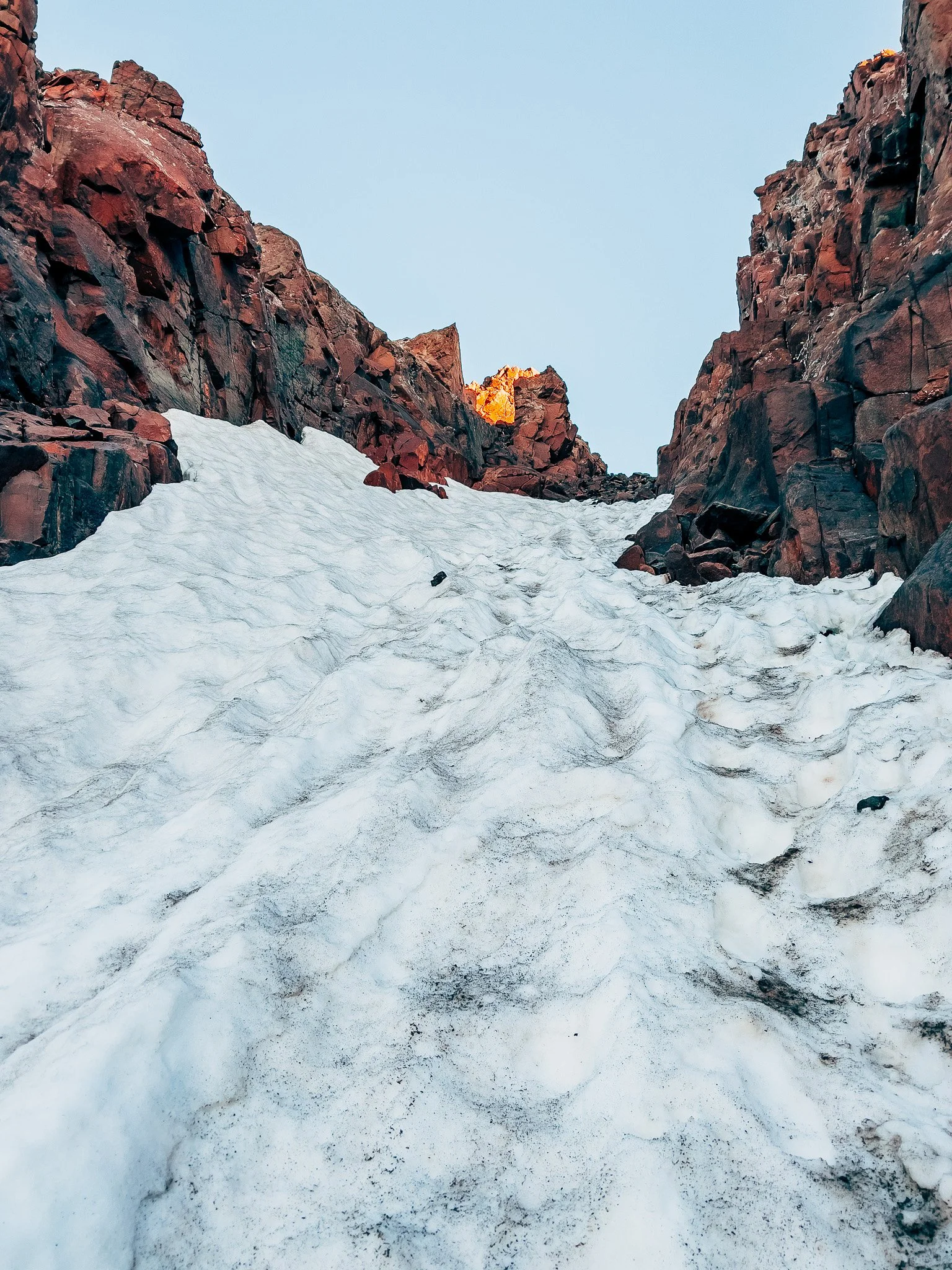
The V-Notch — Class 3 Crux
The crux: the V-notch. A narrow rock slot with a steep drop just behind you. I wedged through carefully — it's the real Class 3 move of the route, and the only spot that demands full attention.

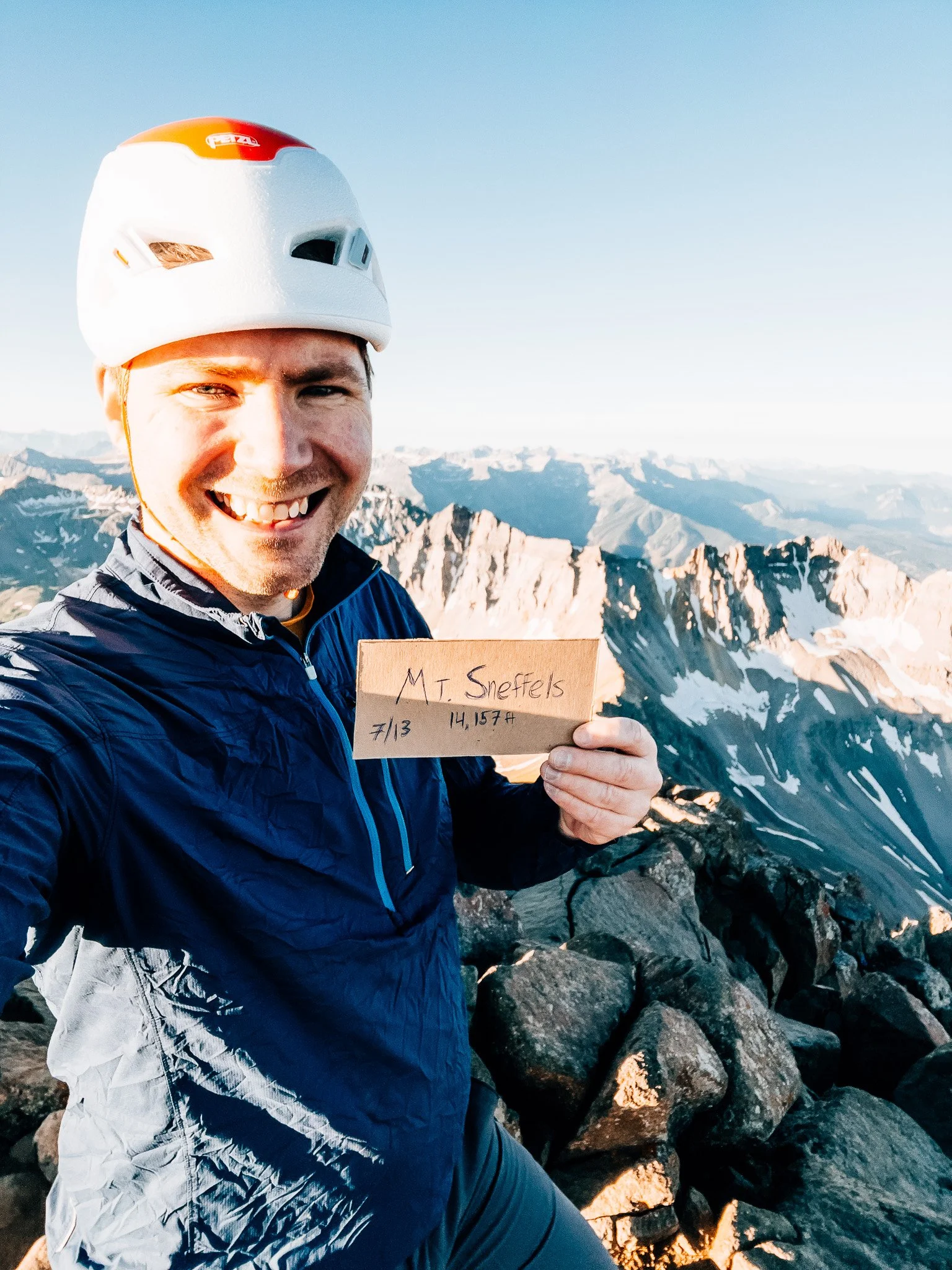
Mount Sneffels Summit — 14,150 ft
Cleared the notch, scrambled the last short stretch, and stood on top at 6:47. This is why I do this. A full 360° of the San Juans, the Blue Lakes Basin below, Telluride off in the distance — and the summit entirely to myself. I could even pick out my Jeep, a tiny speck far below.

Back Down the Scree
Started down at 7:33. The scree was just as annoying going down as up — I slipped twice but stayed upright. Down through the notch, the chimney, and the long loose gully.
Back at the Jeep
Back at the Jeep by 8:50. Tired legs, full heart — a short hike with an outsized payoff, and one of the best summit mornings I've had.
Hike Summary
- Name
- Mount Sneffels
- Location
- Sneffels Range, San Juan Mountains, CO
- Route
- Upper Yankee Boy Basin 4WD TH → Scree Gully → Saddle → Chimney → V-Notch → Summit (out & back)
- Distance
- 2.4 miles
- Elevation Gain
- ~1,600 feet
- Total Time
- 4 hrs 10 min
- Class
- Class 3
- Access
- Upper Yankee Boy Basin trailhead above Ouray — rough, high-clearance 4WD road; short-wheelbase vehicles strongly recommended above the warning sign.
Trail Features
What you'll find along the way —
-
01
Jeep Road
A rough 4WD road above the lower trailhead — high clearance and short wheelbase strongly recommended beyond the warning sign.
-
02
Scree Gully
Loose, sliding rock for the main stretch of the climb — deliberate footing required the entire way up.
-
03
The Chimney
A narrow rock gully that holds a firm snow patch in early season — manageable without crampons on the way up, though worth packing just in case.
-
04
Class 3 V-Notch
The technical crux of the route — a narrow rock slot with a steep drop directly behind you. Full attention required here.
-
05
360° Summit Views
A wide-open panorama of the San Juans, with the Blue Lakes Basin directly below and Telluride visible in the distance.
Recorded with Strava
Open Activity Recorded with Strava
Gallery


Until the next ridge,
Anton
Follow the trail @antonpugphoto →

Disclaimer
Everything you find here, whether it's a hiking guide or a trail story, is meant for inspiration, not instruction. I'm not a guide, and I'm not responsible for what happens if you decide to follow a wrong turn or take on more trail than you're ready for.
The outdoors can be unpredictable, so always use your own judgment, check official resources, and know your limits. By using this site, you agree it's all at your own risk. Take what inspires you, leave what doesn't, and go make it your own adventure.
Enjoyed the trip report? Pass it along to a hiking partner.