Mount Uncompaghre 14er Hike – Trail Guide & Trip Report (San Juan Mountains, Colorado)
San Juan Mountains, Colorado · 38.07°N 107.46°W
Uncompahgre
Peak
Nellie Creek TH → Alpine Meadows → Summit Block → Return
- Dist
- 7.5 mi
- Gain
- 3,000′
- Time
- 4:45

The Trail
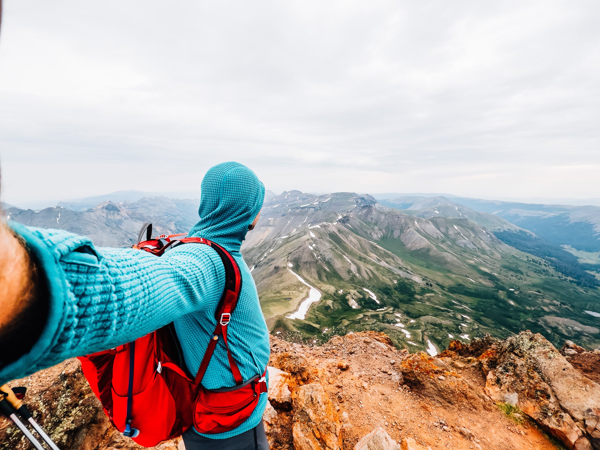
A steady climb through rolling alpine meadows leads to one of Colorado's most distinctive summits. With its broad, blocky crown and dramatic cliff edges, Uncompahgre Peak stands apart — geologically and visually — from any other 14er in the state.
At 14,309 feet, Uncompahgre is the highest peak in the San Juan Mountains and the sixth-highest in Colorado. Its mesa-like summit block rises abruptly out of gentle tundra, one face dropping away in a sheer cliff that makes the mountain instantly recognizable from miles away.
The standard route climbs from the upper Nellie Creek 4WD trailhead — a rough, narrow road best left to high-clearance vehicles. From there the trail is mostly easy, rolling through alpine meadows before a short, non-exposed scramble of about fifty feet gains the summit. The catch in summer is timing: San Juan monsoon storms build fast, so an early start is essential.

FROM THE TRAIL JOURNAL
Field Notes
When I came out to Colorado this summer, I had high hopes of summiting four 14ers. After breezing up Mount Sneffels and Handies Peak, I had my sights set on something bigger — Redcloud and Sunshine. But with monsoon season kicking in and afternoon storms rolling in by 1 or 2 p.m., I knew a long day above treeline wasn't going to happen. Instead I shifted to Uncompahgre, a mountain I wasn't even sure would be accessible — the road had been closed for construction earlier that week and reopened just in time.
Rather than wake at 3 a.m. for the rough drive, I slept at the trailhead. It dropped to 35°F and I shivered through most of the night, but it beat driving that road in the dark. The reward was a cool, overcast, storm-free morning and a summit completely to myself.
Moody skies, an empty trail, and the strangest, most striking summit block in Colorado.
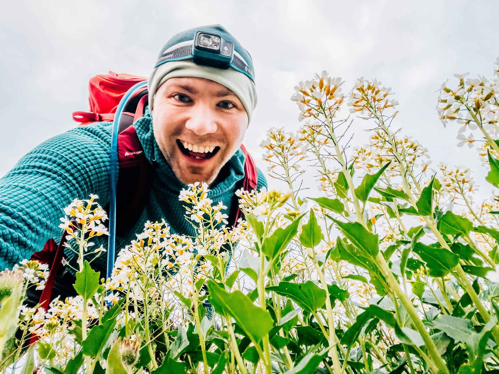
— Anton

Trail Diary
The Drive Up
Rather than waking at 3 a.m. to drive a rough 4WD road in the dark, I headed out the evening before to sleep at the trailhead. The drive from Mill Creek Campground through Lake City took about 45 minutes, most of it rugged, high-clearance terrain. This road was a different beast — incredibly narrow, lined with branches and brambles, steep switchbacks, and several creek crossings. The recent roadwork had left some rebar rods exposed in the dirt, and on my way down one of them punctured a tire. So heads up if you drive it. I reached the trailhead just before midnight and settled into the back of the Jeep. It dropped to 35°F overnight and I shivered through most of it.
First Light at the Trailhead
I woke just as the first light was breaking. The sky was totally overcast and I was a little nervous about rain. A few other cars had arrived overnight — maybe three or four total. I got ready quickly and hit the trail.

Above Treeline
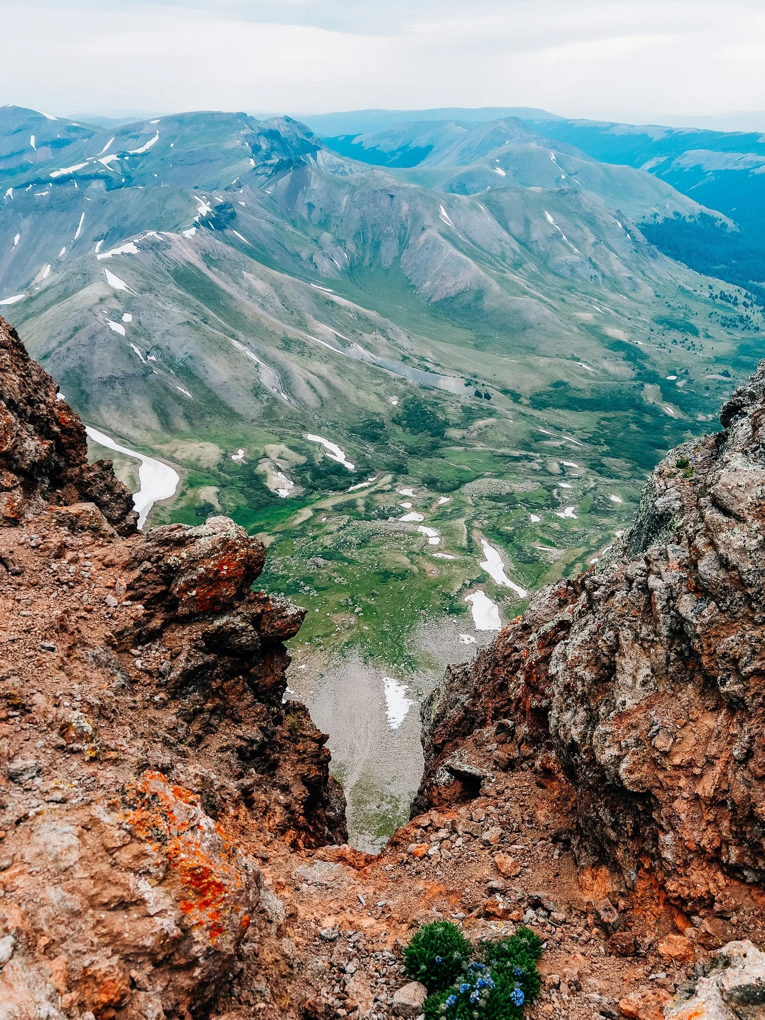
The first part of the hike wound briefly through a small grove of trees. By about half a mile in, I was above treeline. The trail opened up to wide alpine meadows with views in every direction — not as many wildflowers as American Basin, but still a gorgeous setting.

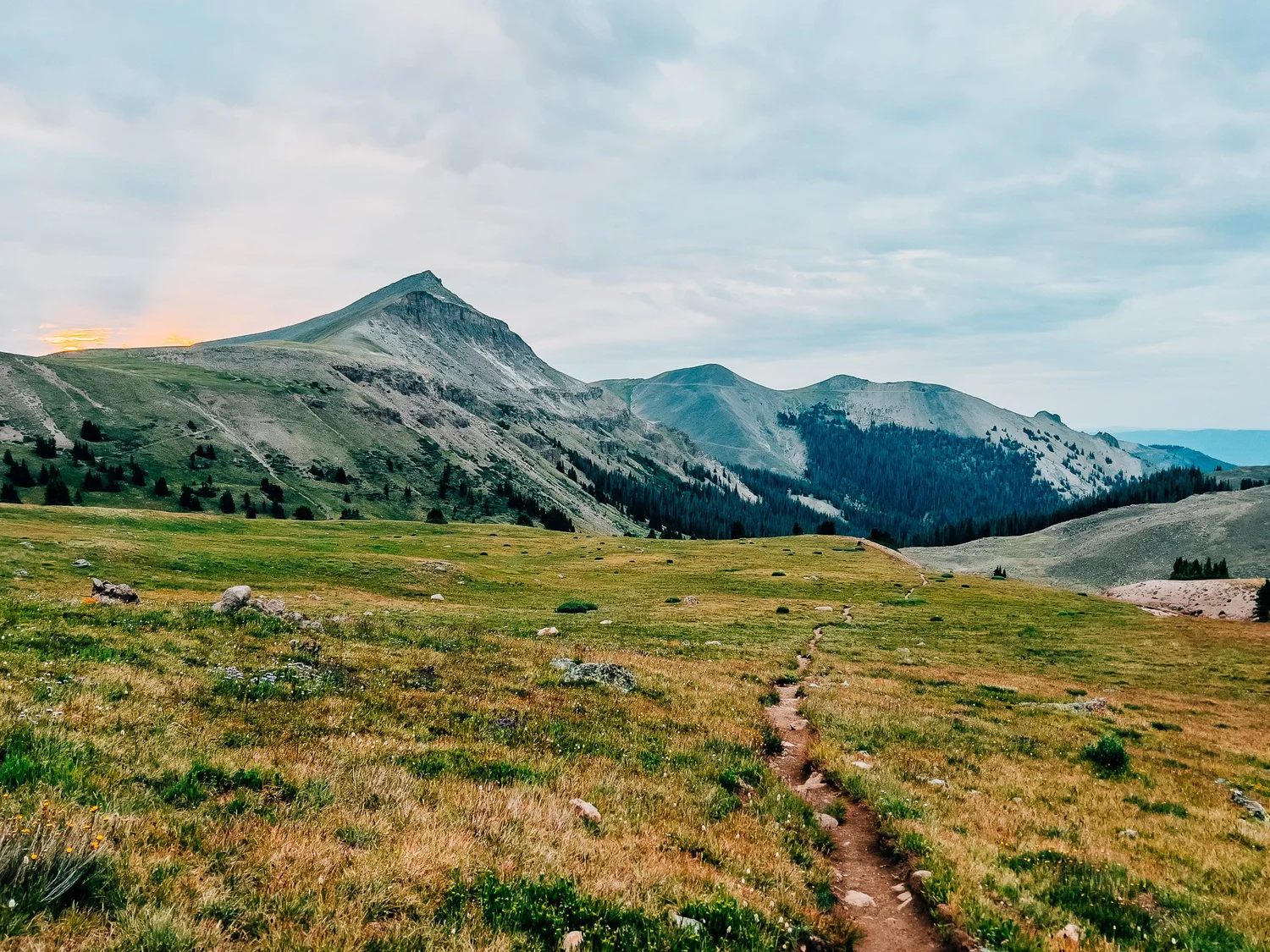

Summit Comes Into View
The trail was gentle and well-graded as I continued climbing through the open tundra. Rolling grassy hills surrounded me, and the mesa-like summit of Uncompahgre came into view. The cloud cover was still thick, but a brief beam of sunlight broke through around 6:15 and lit up the summit beautifully. Streams crossed the trail in places, flanked by clusters of wildflowers.
Toward the Ridgeline
The trail gradually turned left, starting to wrap toward the ridgeline leading up to the summit block. It was still an easy climb, and the cool air made it perfect hiking weather. I was still dry, which felt like a gift given the forecast.

First Saddle
I reached the first saddle and looked out over the backside of the surrounding peaks. From here, the trail turned back toward Uncompahgre and began to climb a bit more aggressively.

The Climb Steepens
The incline steepened, but the trail remained solid and clear. Pikas darted between rocks and a few patches of delicate wildflowers clung to the hillside. Compared to other San Juan hikes, this section felt much drier.

Final Saddle & the Scramble
I reached the final saddle and started wrapping around to the summit's backside. Here the trail dipped slightly and the terrain got rockier. There's a short section of near-scrambling — nothing exposed or dangerous, only about 50 feet. Looking down, it appears steep, but it doesn't feel sketchy when you're on it. A solid, manageable finish.


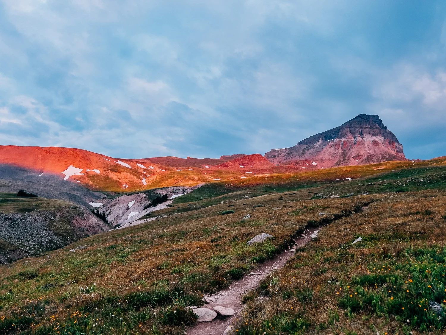
Uncompahgre Summit — 14,309 ft
Summit! The top of Uncompahgre is broad, flat, and windswept, with a rugged sandstone-like texture. One side drops off in a massive cliff, so definitely stay back from the edge. The skies were still moody and gray, with thickening clouds — storms were clearly forming in the distance. I didn't linger long.

Heading Back Down
I started heading back down. On the descent I took a few more flower photos and kept a steady pace, keeping an eye on the building clouds.

Back at the Trailhead
Back at the trailhead. 7.5 miles and nearly 3,000 feet of gain — definitely more effort than Handies, but still one of the more straightforward 14ers. Just watch out for that road.
Hike Summary
- Name
- Uncompahgre Peak
- Location
- San Juan Mountains, Uncompahgre Wilderness, CO
- Route
- Upper Nellie Creek 4WD TH → Alpine Meadows → Saddles → Summit Block scramble (out & back)
- Distance
- 7.5 miles
- Elevation Gain
- ~3,000 feet
- Total Time
- 4 hrs 45 min
- Class
- Class 2
- Access
- Upper Nellie Creek trailhead via Lake City — narrow, rugged road with creek crossings; high-clearance 4WD strongly recommended. Watch for exposed rebar from recent roadwork. Start early to beat monsoon storms.
Trail Features
What you'll find along the way —
-
01
Rolling Alpine Meadows
The bulk of the route climbs gently through wide-open tundra with 360° views. Grassy and expansive — nothing like the tight switchbacks on most 14ers.
-
02
Wildflowers & Pikas
Clusters of wildflowers line the stream crossings mid-route, and pikas are everywhere on the rocky upper slopes — listen for their sharp calls between the boulders.
-
03
Dual Saddles
Two distinct saddles break up the upper climb. The first opens up a sweeping backside view; the second deposits you below the final scramble section.
-
04
Short Summit Scramble
About 50 feet of Class 2+ hands-on terrain just below the summit. Looks intimidating from below — but once you're on it, the holds are solid and it's very manageable.
-
05
Cliff-Edge Summit Block
The summit plateau is broad, flat, and unlike any other 14er — one edge drops into a sheer cliff. Stay well back. The views stretch deep into the San Juans on all sides.
Recorded with Strava
Open Activity Recorded with Strava
Gallery


Until the next ridge,
Anton
Follow the trail @antonpugphoto →

Disclaimer
Everything you find here, whether it's a hiking guide or a trail story, is meant for inspiration, not instruction. I'm not a guide, and I'm not responsible for what happens if you decide to follow a wrong turn or take on more trail than you're ready for.
The outdoors can be unpredictable, so always use your own judgment, check official resources, and know your limits. By using this site, you agree it's all at your own risk. Take what inspires you, leave what doesn't, and go make it your own adventure.
Enjoyed the trip report? Pass it along to a hiking partner.