Mount Hale via Hale Brook Trail, Lend-A-Hand, Zealand Notch Trail – Trail Guide & Trip Report (White Mountains, NH)

White Mountains, New Hampshire · 44.22°N 71.55°W
Mount
Hale
Hale Brook Trail → Lend-a-Hand Trail → Zealand Notch Trail
- Dist
- 9.6 mi
- Gain
- 2,387′
- Time
- 4:28
The Trail
A quiet wooded climb over Mount Hale, followed by a scenic descent past Zealand Falls Hut and through the ponds, wetlands, and boardwalks of Zealand Notch — a variation that turns one of the quieter NH 48 summits into a far more interesting White Mountains loop.
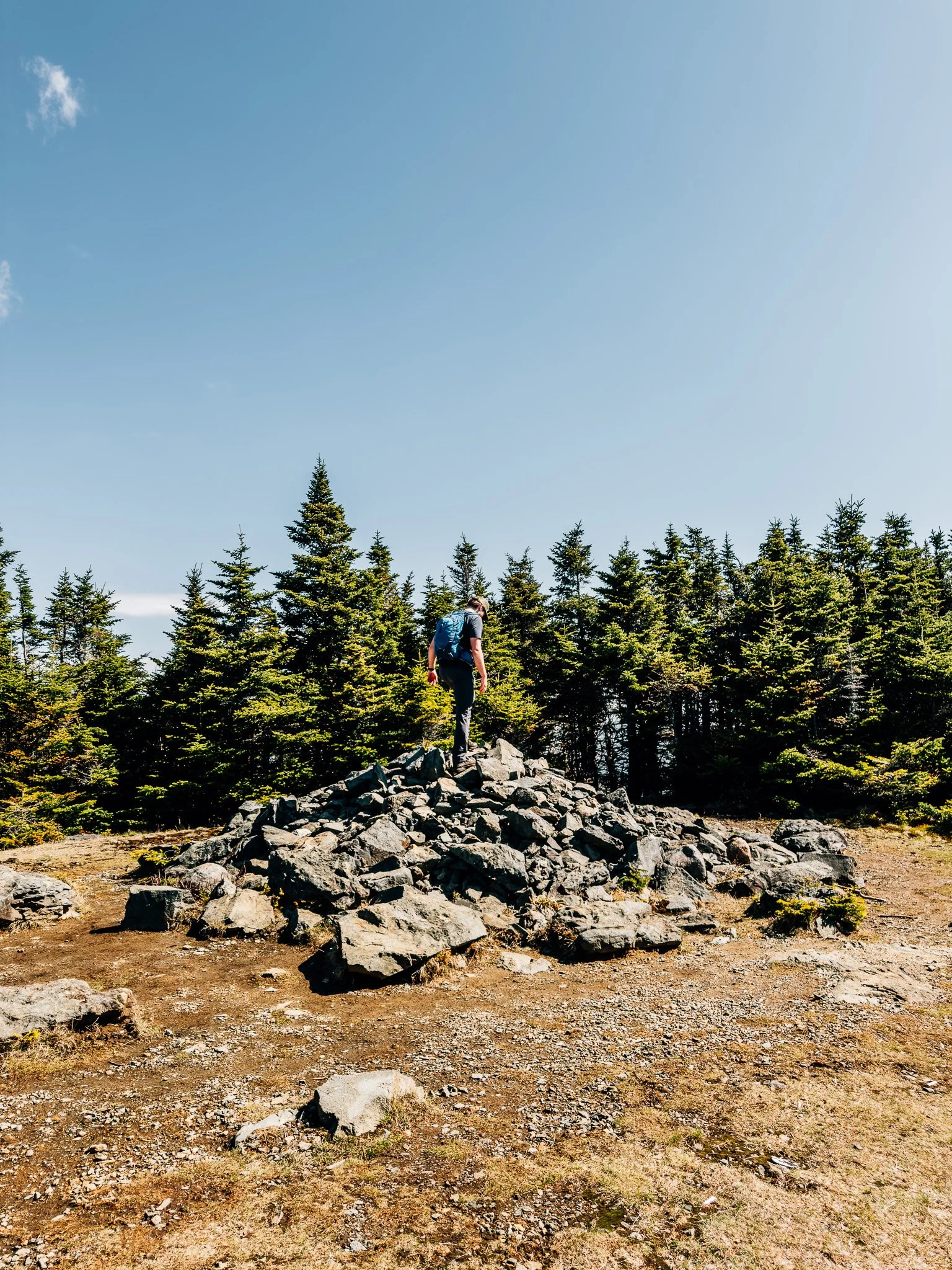
At 4,057 feet, Mount Hale sits on the western edge of the Pemigewasset Wilderness, one of New Hampshire's 4,000-footers and a fixture on the NH 48 list. Its summit is famously wooded — a broad cairn marks the high point where a fire tower once stood, and local lore says the magnetic rocks throw a compass off true.
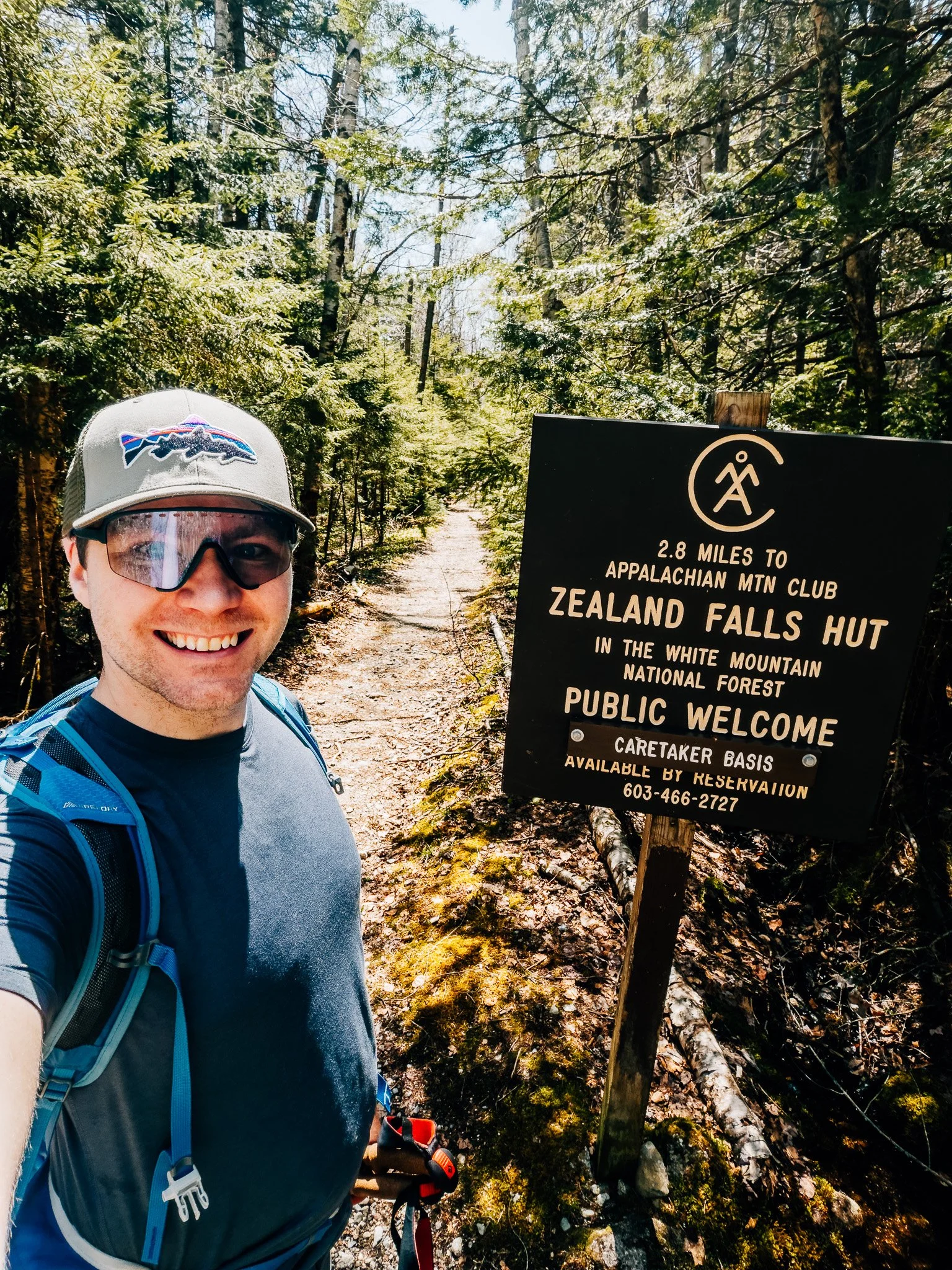
Rather than retrace the standard up-and-back on Hale Brook Trail, this route drops off the back on Lend-a-Hand Trail toward Zealand Falls Hut, then threads out through Zealand Notch — a chain of beaver ponds, marsh, and boardwalks beneath the cliffs of Zeacliff and Whitewall. It's a longer day, but a far more scenic one.

FROM THE TRAIL JOURNAL
Field Notes
I finished my New Hampshire 48 last fall, so this one wasn't about the list. I just wanted to be out in the Whites on a quiet spring morning with nothing to prove and no summit to chase.
The climb up Hale Brook was slow and green — trillium everywhere, the brook running high with melt. There were no views from the wooded top, but dropping into Zealand Notch in the afternoon light reminded me exactly why I started doing this.
Some mountains you climb to finish something. This one I climbed to start again.
— Anton

Trail Diary
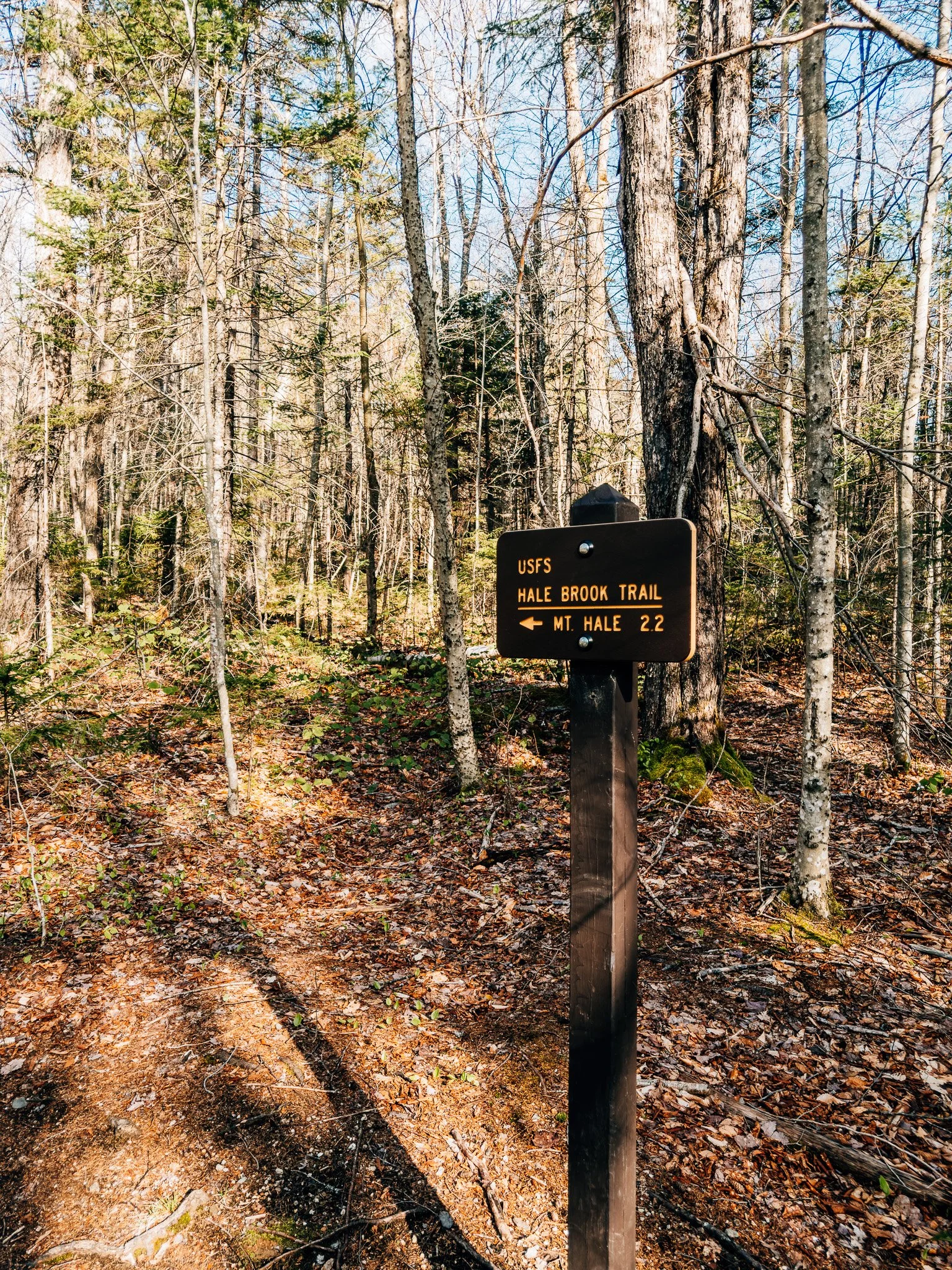
Hale Brook Trailhead
The weather is perfect this morning. Clear skies, cool air, and the kind of light that makes you want to be on the trail. The parking area is nearly empty—just a few other hikers gearing up.
I run through my pack one more time. Water, snacks, map, first aid kit. Everything's where it should be. Time to head up.
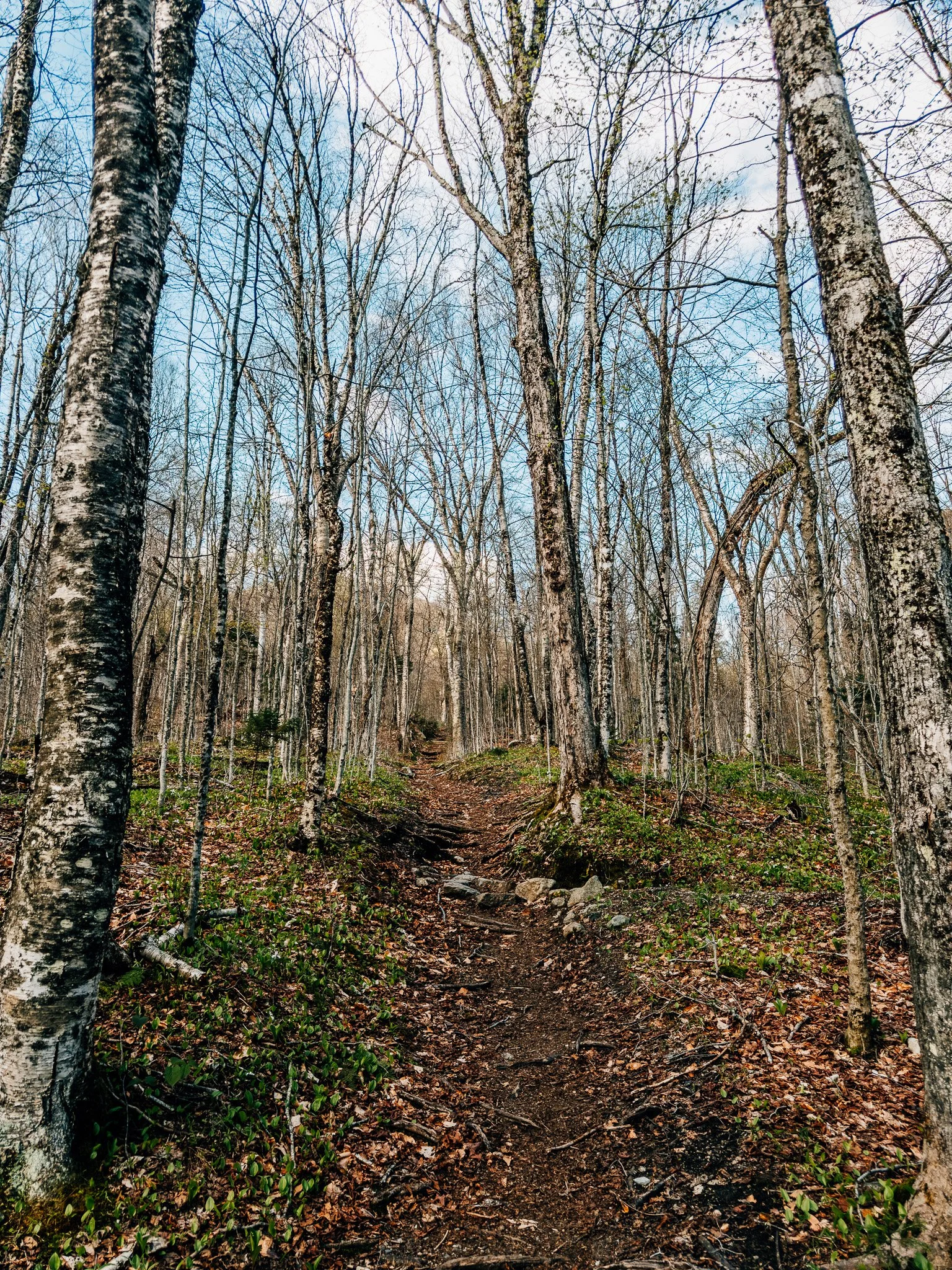
Lower Hale Brook Trail
The trail begins climbing gradually through old-growth maple and beech forest. This was still early spring, so the understory had beautiful trillium blooms. Hale Brook Trail crosses the brook several times, but there are no major stream crossings.

Mount Hale Summit
The summit of Hale is famously wooded, with a large cairn marking the high point where a fire tower once stood. There's a long-told story that the cairn's magnetic rocks throw off your compass — worth testing if you carry one. No big views up top, but it's a calm, mossy place to sit for a few minutes.
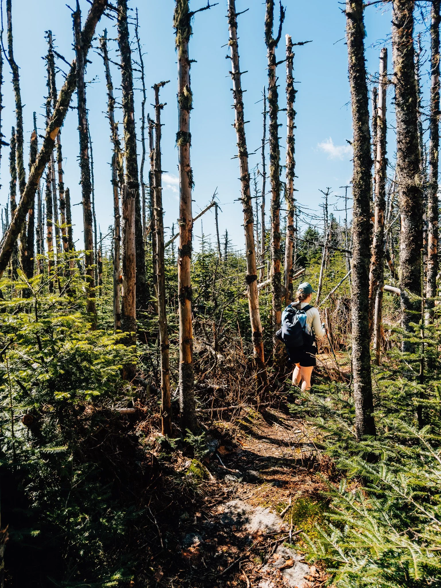
Lend-a-Hand Trail
From the summit I dropped onto Lend-a-Hand Trail toward the Zealand Falls Hut. This stretch is a patchwork of bog bridges and roots threading through stunted spruce — slow, quiet walking with a few open windows out toward the Pemigewasset Wilderness.
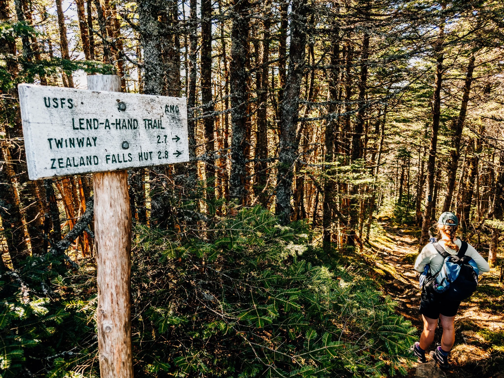
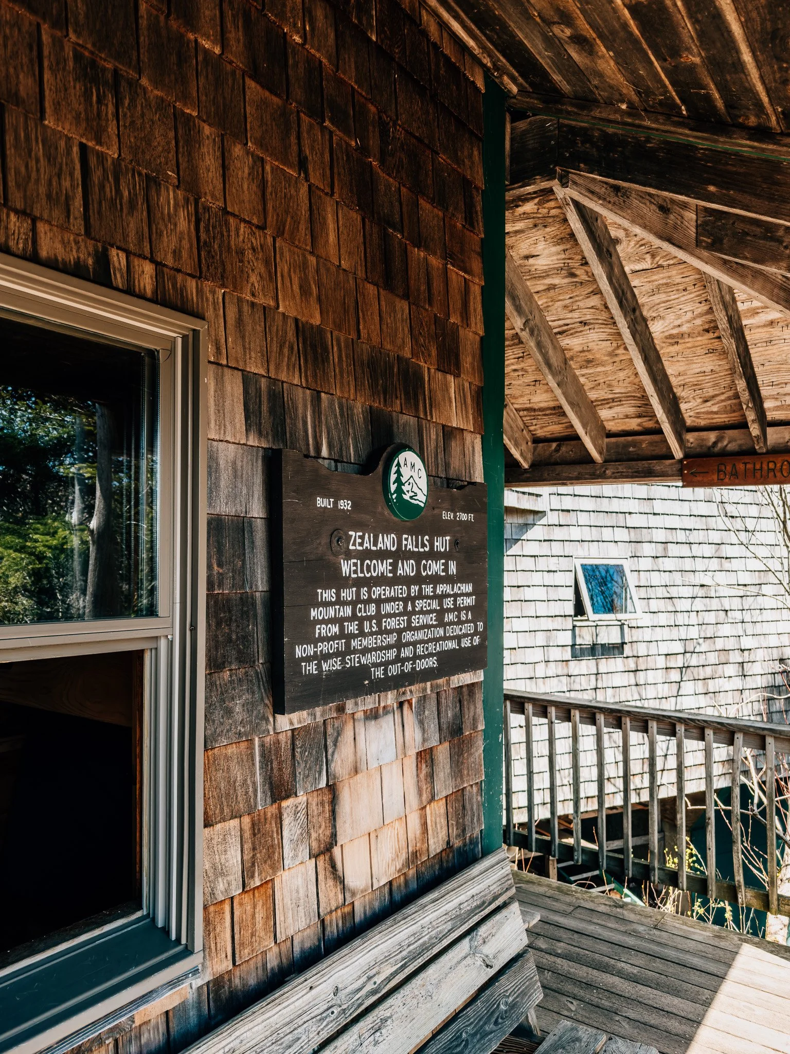
Zealand Falls Hut
The AMC's Zealand Falls Hut sits right above the cascades, and it makes a perfect halfway stop. I refilled water, ate lunch on the rocks, and watched the falls run high with spring melt before continuing down into the notch.
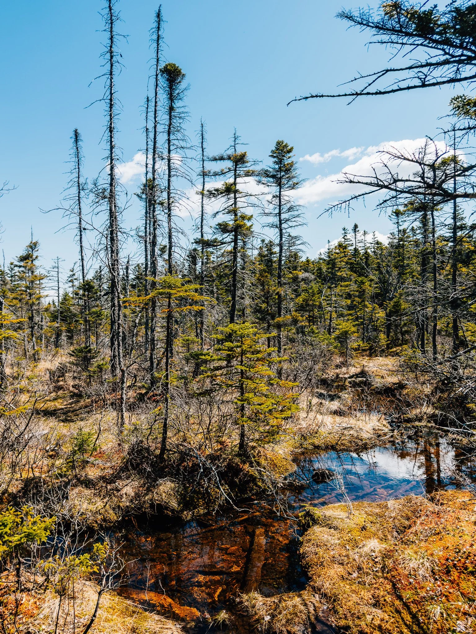
Zealand Notch
This is the payoff. The trail opens into the broad Zealand Notch wetland — a chain of beaver ponds, marsh, and long boardwalks with the cliffs of Zeacliff and Whitewall Mountain rising on either side. Easily the most scenic stretch of the day, and a completely different feel from the wooded summit.

Zealand Trailhead
Finished at the Zealand Trailhead, then had a short one-mile road walk back to the car at Hale Brook Trailhead.
Hike Summary
- Name
- Mount Hale
- Location
- White Mountain National Forest, NH
- Route
- Hale Brook Trail → Lend-a-Hand Trail → Zealand Trail
- Distance
- 9.6 miles
- Elevation Gain
- 2,387 feet
- Total Time
- 4 hrs 28 min
- Class
- Class 1
- Access
- Easy 2WD dirt road
Trail Features
What you'll find along the way —
Wooded Climb / Spring Wildflowers / Quiet Summit / Zealand Falls Hut / Cascades / Wetlands / Wildlife Potential / Easy Access
Recorded with Strava
Open Activity Recorded with Strava
Gallery


Until the next ridge,
Anton
Follow the trail @antonpugphoto →

Disclaimer
Everything you find here, whether it's a hiking guide or a trail story, is meant for inspiration, not instruction. I'm not a guide, and I'm not responsible for what happens if you decide to follow a wrong turn or take on more trail than you're ready for.
The outdoors can be unpredictable, so always use your own judgment, check official resources, and know your limits. By using this site, you agree it's all at your own risk. Take what inspires you, leave what doesn't, and go make it your own adventure.
Enjoyed the trip report? Pass it along to a hiking partner.