Mount Liberty – Trail Guide & Trip Report (White Mountains, NH)

Franconia Notch, New Hampshire · 44.10°N 71.68°W
Mount
Liberty
Liberty Spring Trail → Franconia Ridge → Summit → Return
- Dist
- 8.4 mi
- Gain
- 3,220′
- Time
- 4:23

The Trail
A late-afternoon push to Mount Liberty the day after a surprise late-May snowstorm — the kind of day where the valley is impossibly green and the peaks above treeline are still draped in white. In New England, we call it snowliage, and it doesn't get more dramatic than Franconia Ridge.
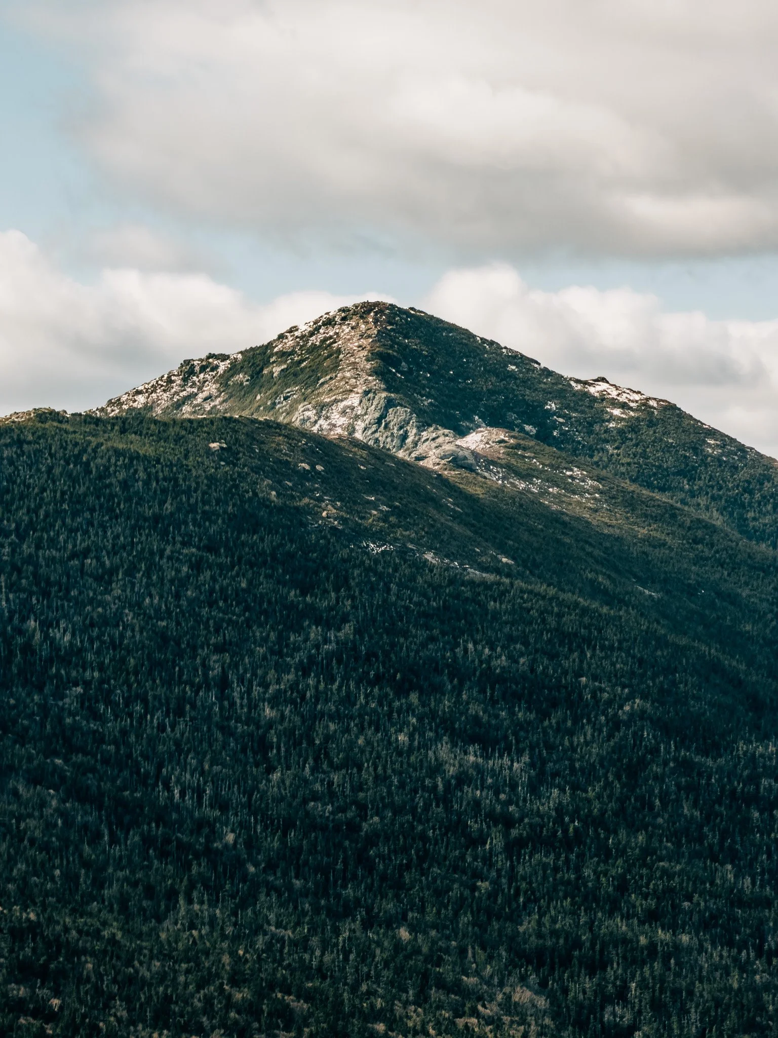
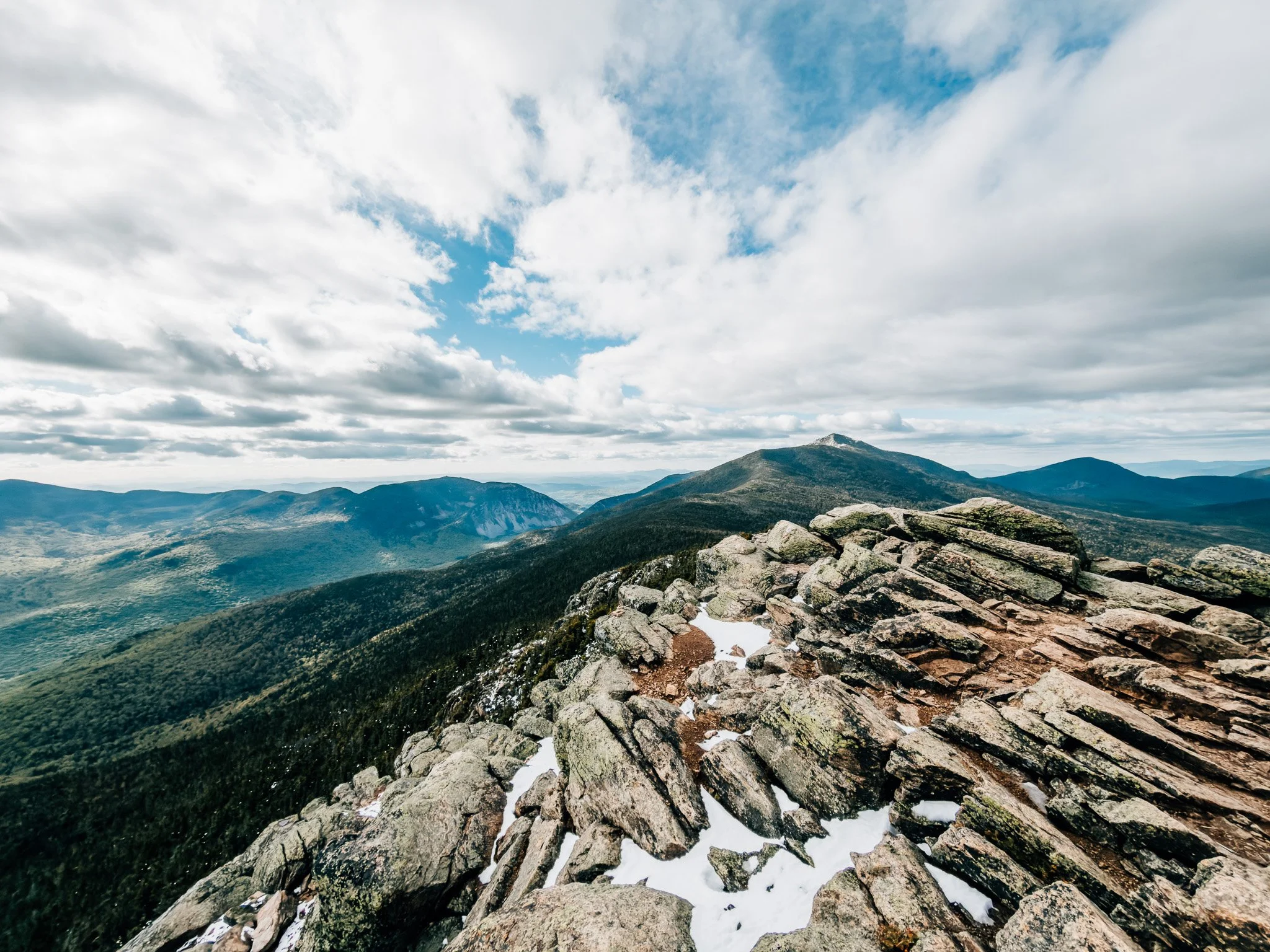
At 4,459 feet, Mount Liberty is one of Franconia Ridge's quieter summits — sitting just south of the Falling Waters trailhead crowds, accessible via the long and steady Liberty Spring Trail. The approach is unique: you park at the Whitehouse Trailhead, walk a short wooded section along I-93, pick up the Franconia Notch bike path, cross a river, and only then reach the Liberty Spring Trailhead proper.
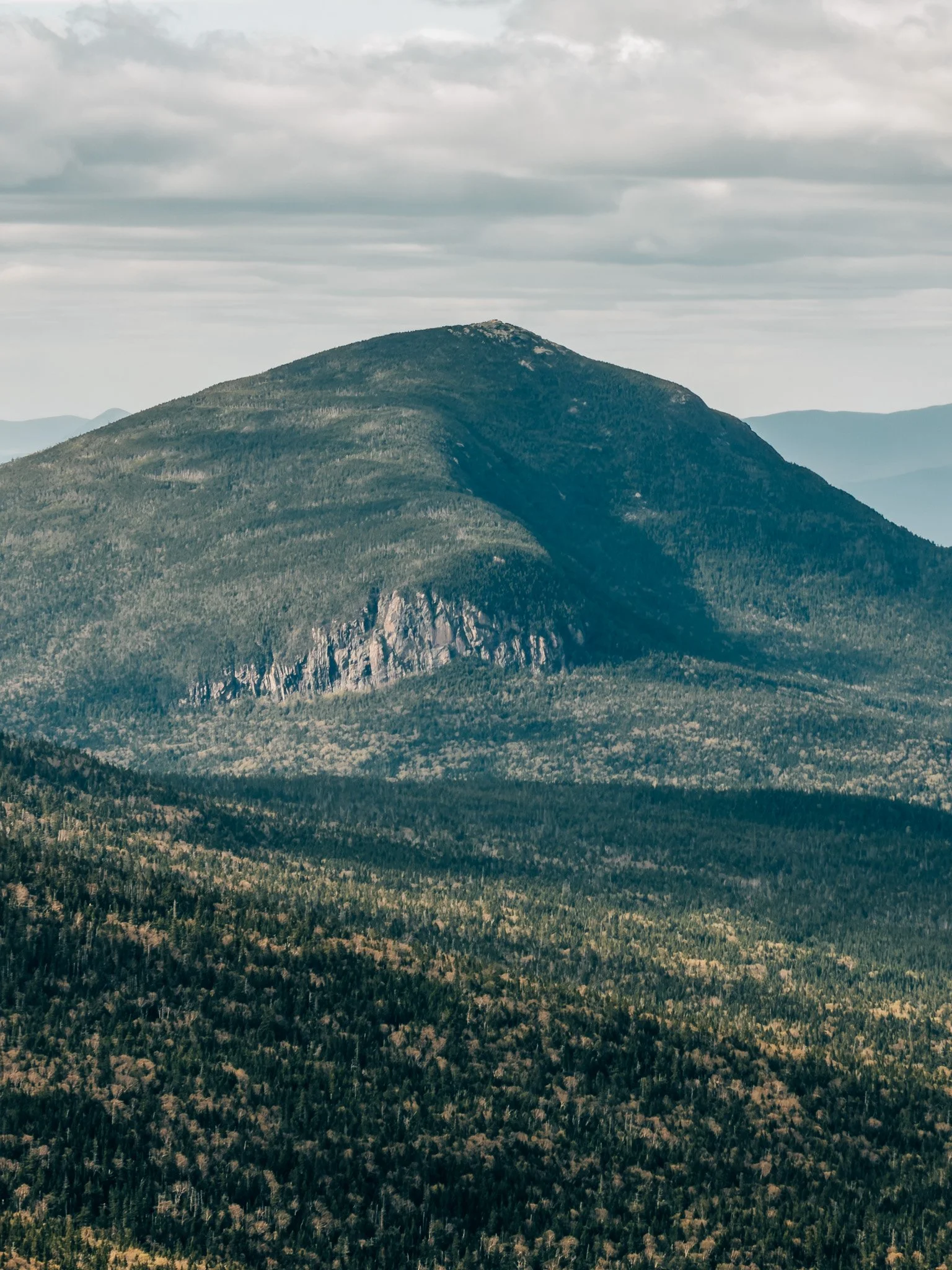
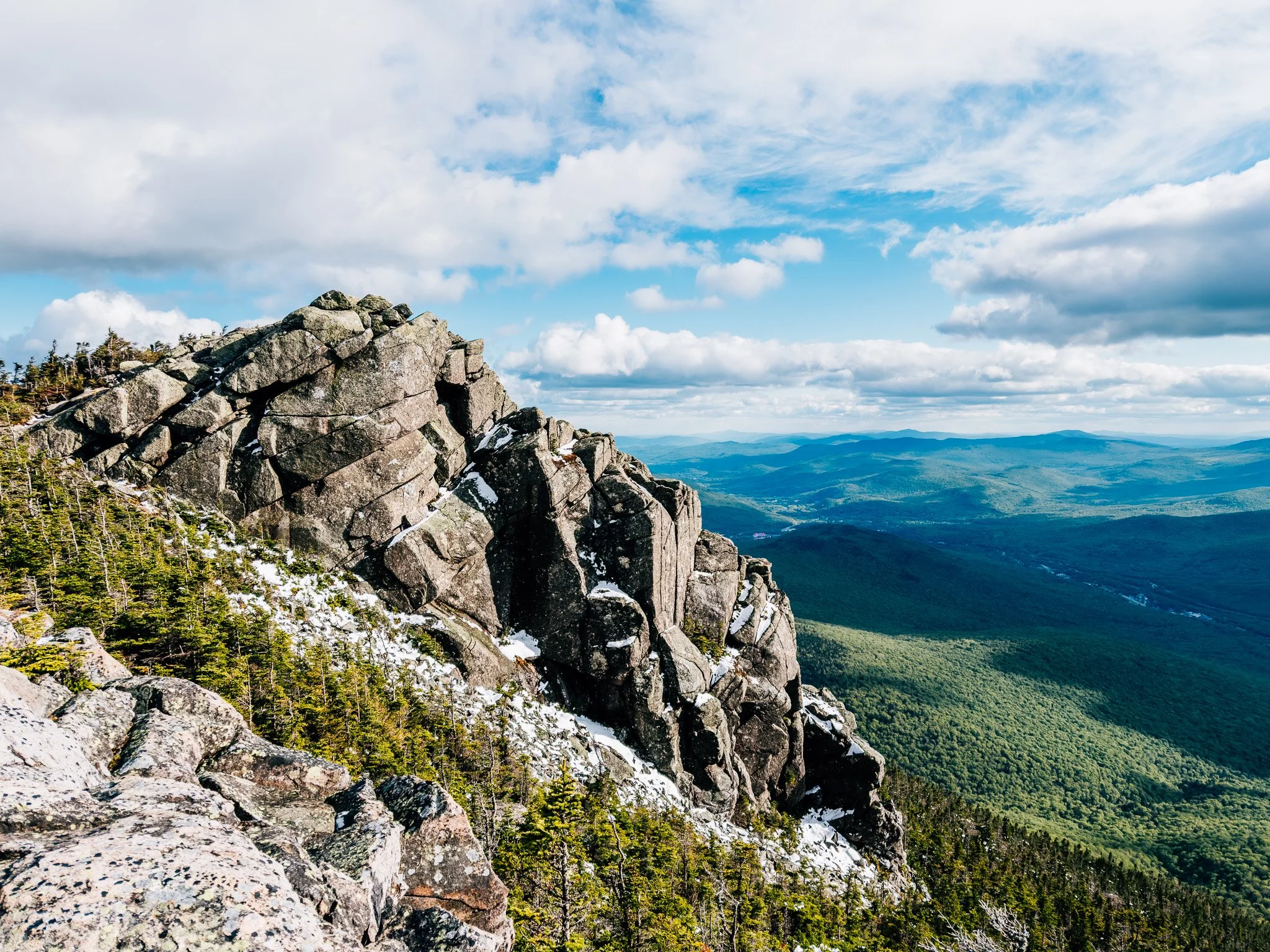
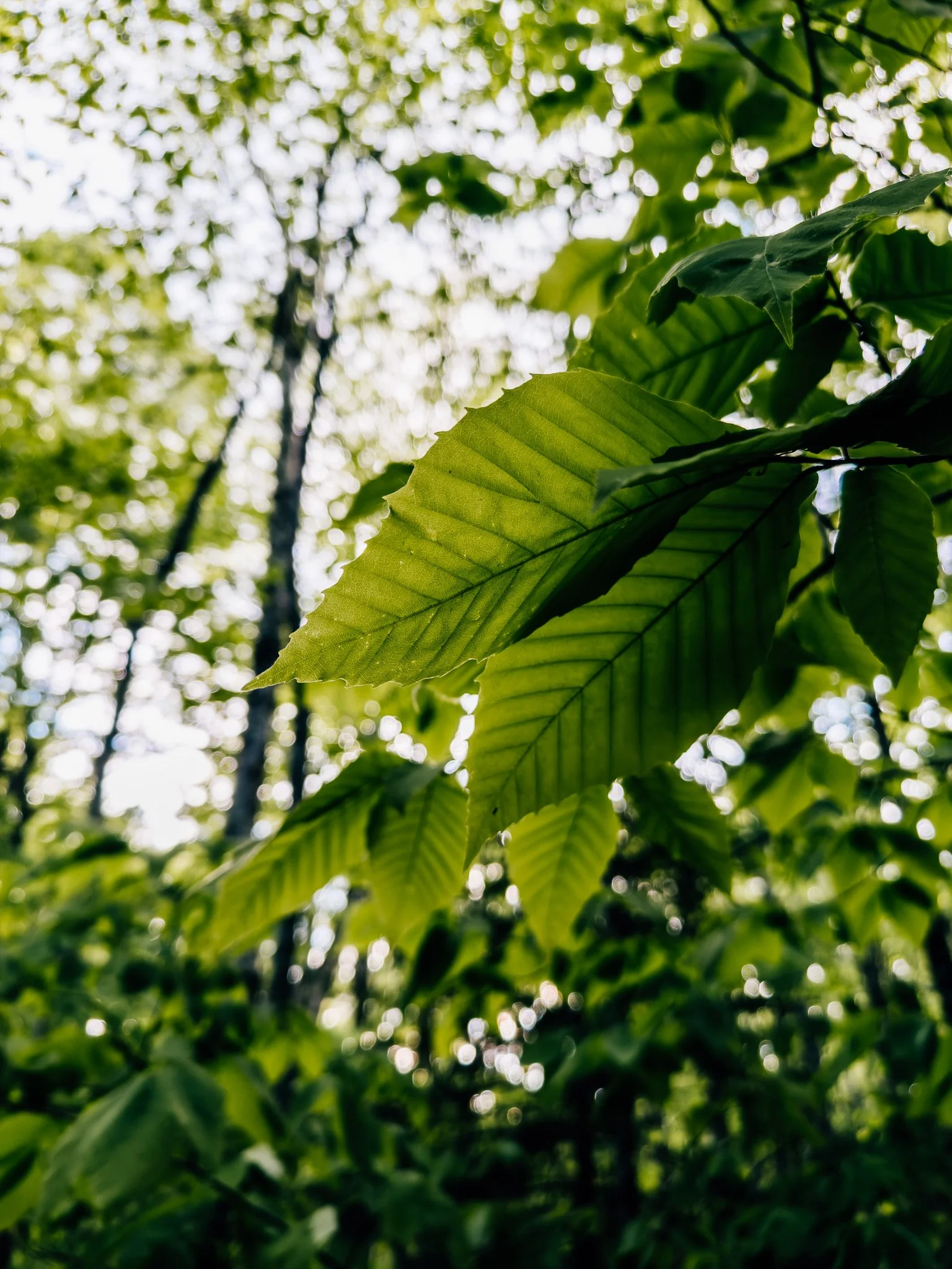
From there it's a sustained 3,000-foot climb through old-growth beech and maple, transitioning into a moss-draped evergreen forest before breaking onto the Franconia Ridge. The summit offers 360-degree views — Cannon Cliff and the notch to the west, the snow-covered Presidentials to the north, and the full sweep of the ridge in both directions.

FROM THE TRAIL JOURNAL
Field Notes
Memorial Day weekend had been a wash — rain all the way through. Then the forecast did something strange: snow, up high, on May 30th. The ski resorts were posting pictures that looked more like April. Some people were actually trying to ski.
I waited for the storm to settle, packed up in the early afternoon, and headed north. I didn't have a specific summit in mind at first. I just wanted to get above treeline and see what late-May snow looks like next to full spring green. That contrast — what we call snowliage in New England — is something you only get a handful of times a year, if you're lucky.
Liberty gave me exactly that. Snow above, green below, and a trail completely to myself.
— Anton

Trail Diary
Whitehouse Trailhead
Arrived to find only three other cars in the lot. On a Saturday, that's remarkable — the rain clearly scared most people off. The quiet was a welcome surprise. Packed up and started through the short wooded section that runs alongside I-93 before picking up the Franconia Notch bike path.
The woods here are unexpectedly pretty in spring — thick ferns and wildflowers line both sides of the path, the kind of lush understory you don't expect this close to the highway.


Liberty Spring Trailhead
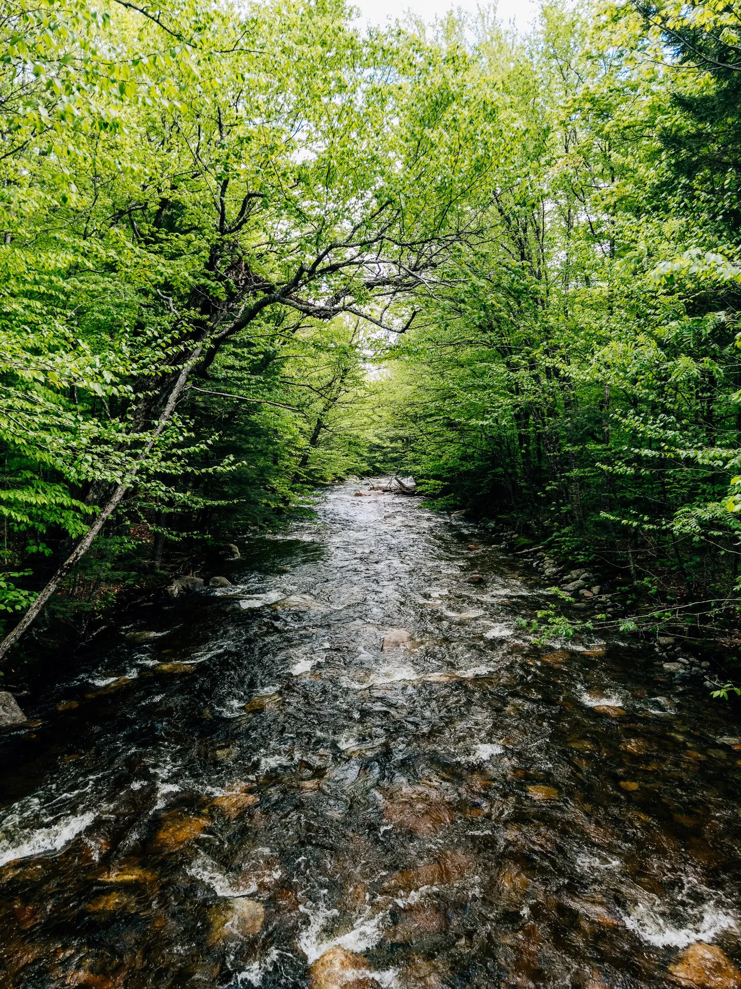
After walking the bike path through Franconia Notch and crossing the river — running fast and full after days of rain and snowmelt — I reached the Liberty Spring Trailhead. There's no parking here; you either walk in from Whitehouse or come from the Basin to the south.
This is where the climb officially begins.
Into the Evergreens
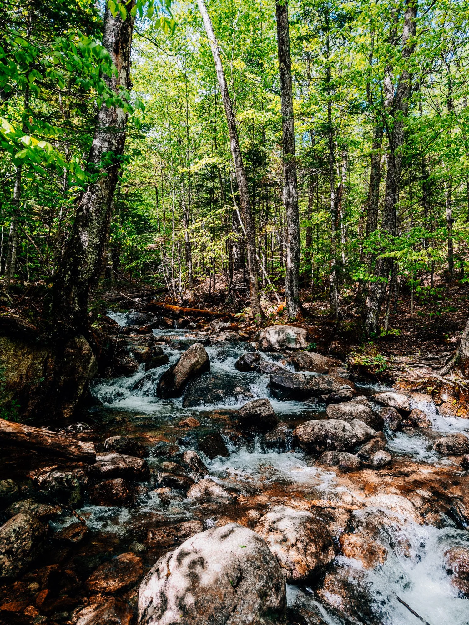
The lower trail winds through old-growth beech and maple with a few easy stream crossings. Then, almost exactly at 4:24, the hardwoods give way and the trail enters the evergreens. It's an immediate shift in character — the canopy closes in, the light turns dim and green, and the trail becomes a straight, steady incline through spruce and fir.
Monotonous in the best way. Moss lines every trunk and rock, and the air smells like cold earth. A little like the Olympic Peninsula in February.

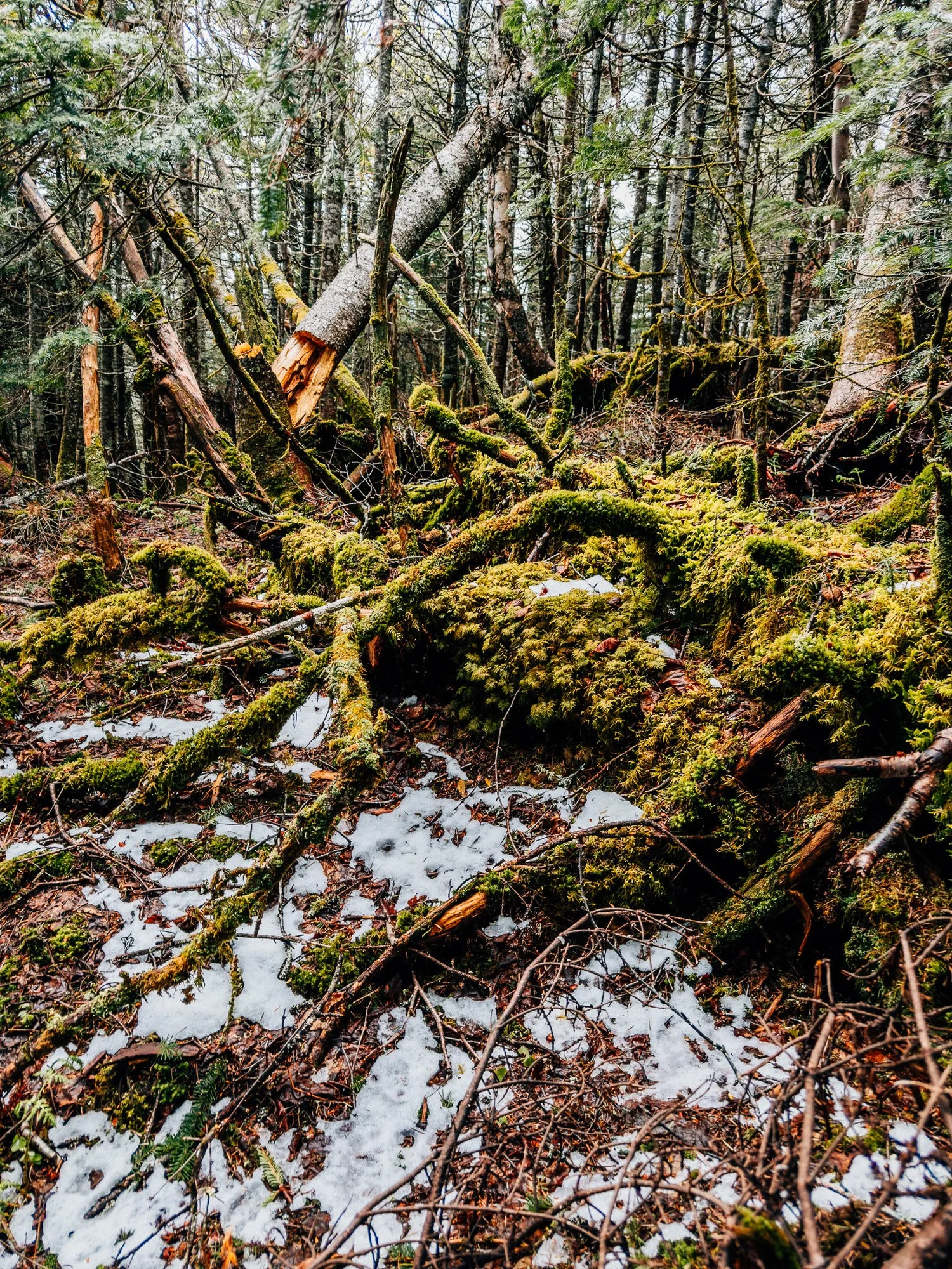
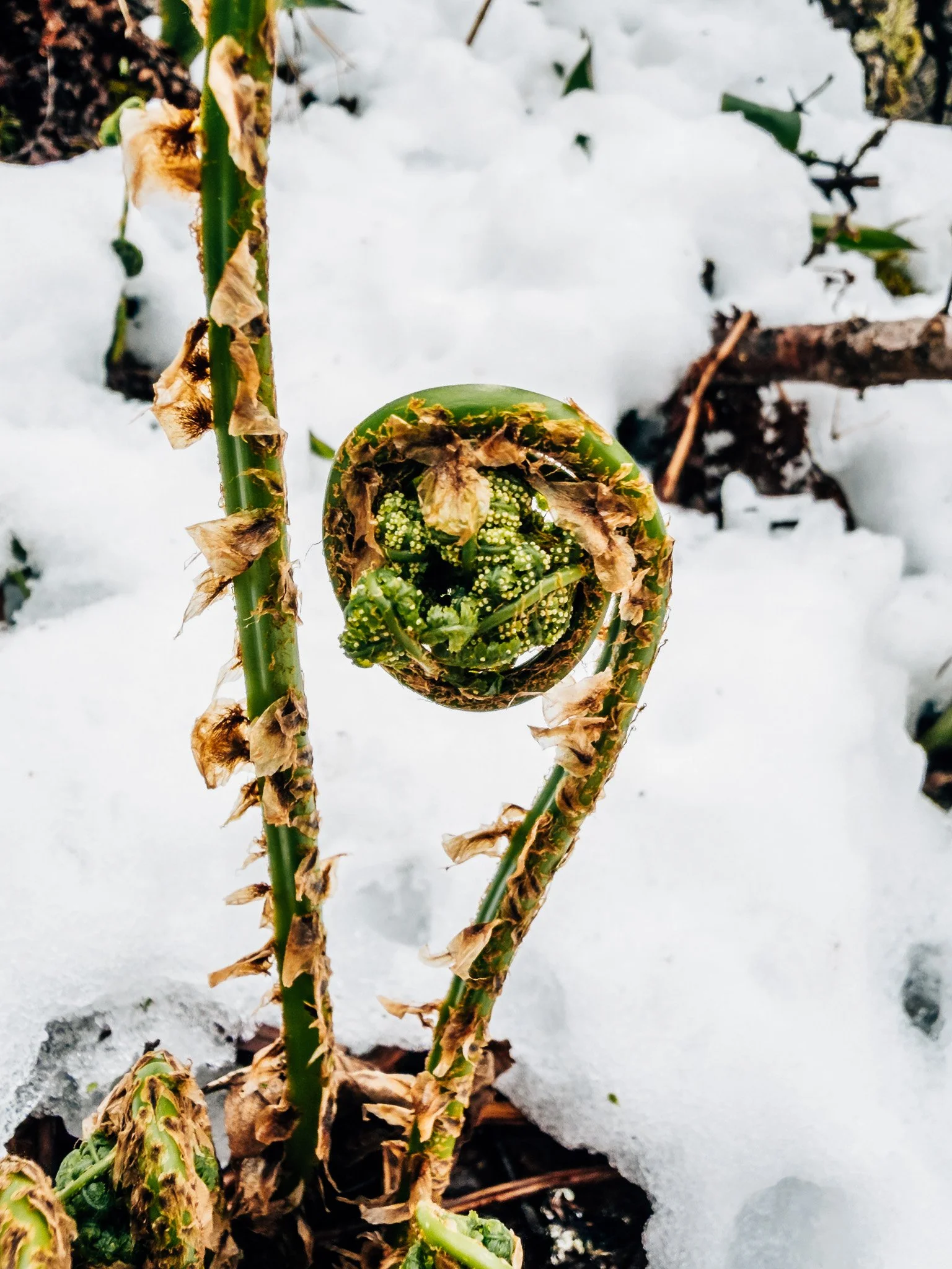
First Snow
The first patches of snow appeared alongside the trail. Bright spring ferns and fresh foliage pushing up right through the white — the contrast was genuinely stunning. The moss on the trees, the snow on the ground, and the smell of cold wet spruce all at once.
Liberty Spring Campsite
The campsite sits in a clearing deep in the evergreens and was completely empty — unusual for a weekend. The storm had kept everyone away.
Backpacking note: There's a caretaker on-site during summer. Overnight fee is $15/person, payable by cash or QR code.

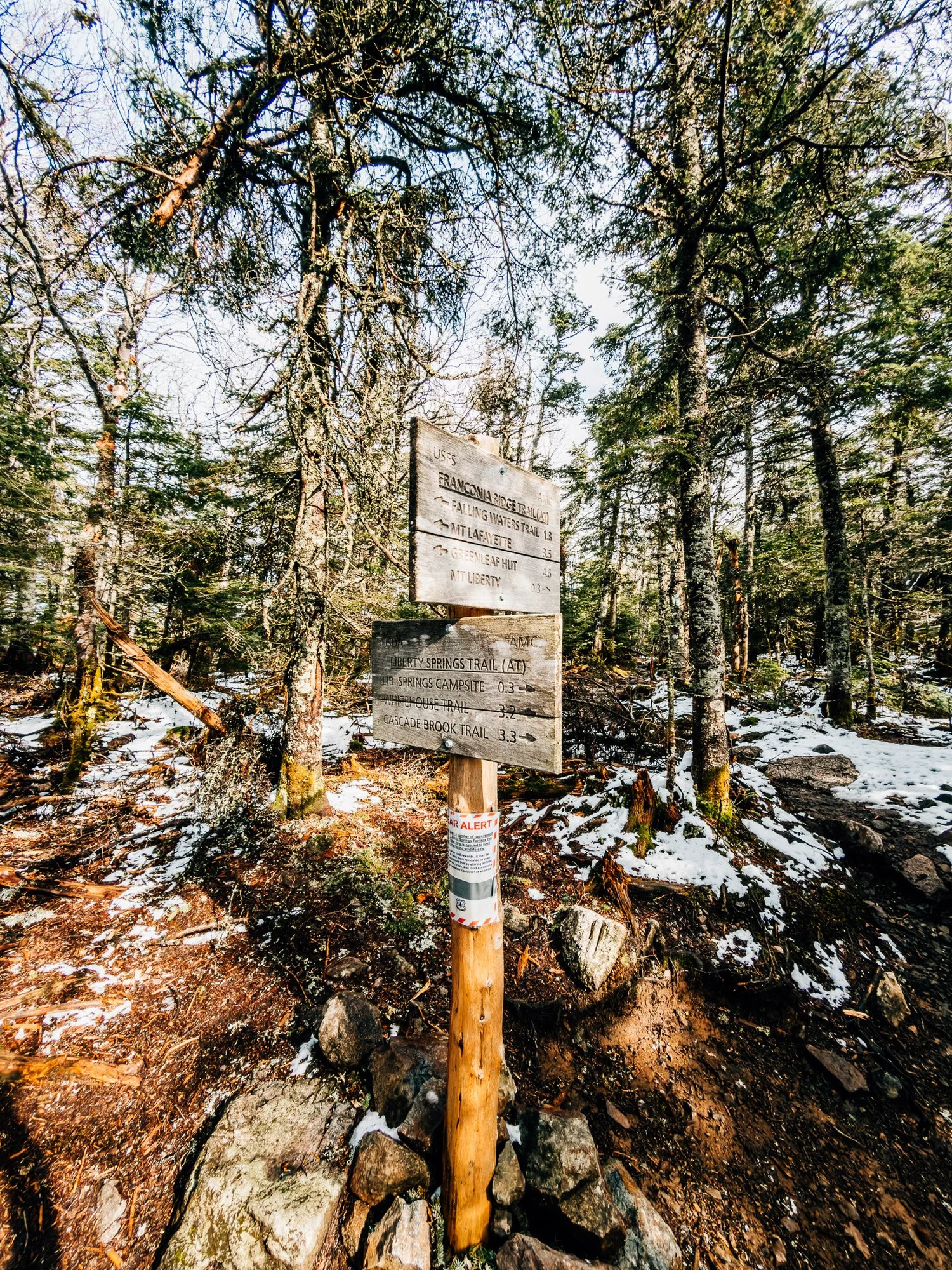
Franconia Ridge Junction
Broke out onto the ridge. Left leads toward Falling Waters Trail, Mount Lafayette, and the rest of Franconia Ridge. I turned right toward Liberty. This short ridge section is one of my favorites on the entire trail — sparse, wind-sculpted trees, lots of dead standing evergreens with young growth in the understory, and ferns and mosses blanketing the ground on both sides. Open sky above after hours in the trees.


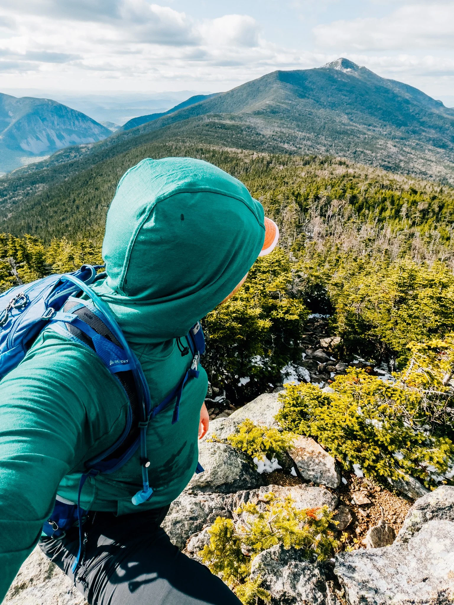
Mount Liberty Summit — 4,459 ft
Three hundred and sixty degrees of open sky. To the west, Cannon Cliff and the length of Franconia Notch — lush and green. To the northeast, the Presidential Range completely snow-covered, brilliant white against the blue sky. The contrast was exactly what I'd come for: snowliage in its most dramatic form.
Took some photos, sat with the views, and let the summit do its thing. Headed back down at 5:45 pm.


Back at the Trailhead
The descent was beautiful — spring foliage at its brightest, that electric early-season green that only lasts a few weeks. Worth taking slowly. One note for future reference: after rain or snow, Liberty Spring Trail turns into something close to a stream in places. Expect to be walking through water on the lower sections if the weather has been wet.
Hike Summary
- Name
- Mount Liberty
- Location
- Franconia Notch State Park, NH / White Mountain National Forest, NH
- Route
- Whitehouse TH → Bike Path → Liberty Spring Trail → Franconia Ridge → Summit (out & back)
- Distance
- 8.4 miles
- Elevation Gain
- 3,220 feet
- Total Time
- 4 hrs 23 min
- Class
- Class 1
- Access
- Whitehouse Trailhead or the Basin — both connect to the Franconia Notch bike path. Paved lot.
Trail Features
What you'll find along the way —
Summit Views / Mosses / Creek Crossings / Backpacking Campsite
Recorded with Strava
Open Activity Recorded with Strava
Gallery


Until the next ridge,
Anton
Follow the trail @antonpugphoto →

Disclaimer
Everything you find here, whether it's a hiking guide or a trail story, is meant for inspiration, not instruction. I'm not a guide, and I'm not responsible for what happens if you decide to follow a wrong turn or take on more trail than you're ready for.
The outdoors can be unpredictable, so always use your own judgment, check official resources, and know your limits. By using this site, you agree it's all at your own risk. Take what inspires you, leave what doesn't, and go make it your own adventure.
Enjoyed the trip report? Pass it along to a hiking partner.